Stage status: Consultation
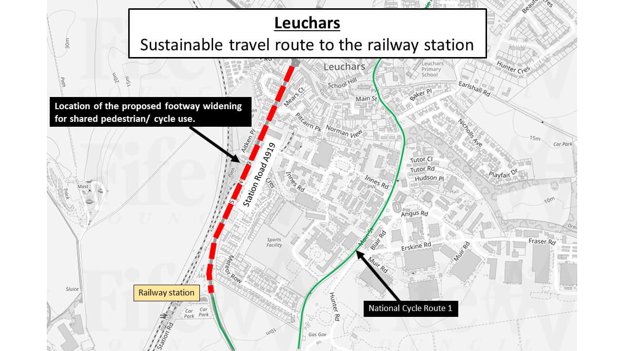
National Cycle Route 1 already passes through the east side of Leuchars, from the A919. This additional route will connect the west side of Leuchars to the railway station, along Station Road.
Footway widening will mainly be undertaken on the western side of A919, from the station northwards to the existing Puffin crossing. Thereafter, the eastern footway will be widened to Main Street, where a 20-mph zone exists and connections to NCN1 can be made.
The upgraded facility will promote and encourage active travel from nearby communities to the train station.
- Timeline: To be completed by March 2024.
- Distance: 800m
- Approximate investment: £240,000
- Key features:
- An off-carriageway shared pedestrian/cycle path, approx 3.5 metre wide, including a 500mm safety zone next to carriageway
- Proposed raised crossings at St. Bunyans Place and Aitken Place
- Upgrade of an existing puffin crossing to a toucan crossing
- A new zebra crossing
- Link to the National Cycle Network
- New bus shelters
If you wish to comment on the works, or need further information, please email: active.travel@fife.gov.uk.